


THEBES Voting District, Alexander County, Illinois
About
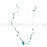
Outline

Summary
| Unique Area Identifier | 564535 |
| Name | THEBES Voting District |
| County | Alexander County |
| State | Illinois |
| Area (square miles) | 30.31 |
| Land Area (square miles) | 28.72 |
| Water Area (square miles) | 1.59 |
| % of Land Area | 94.75 |
| % of Water Area | 5.25 |
| Latitude of the Internal Point | 37.21109020 |
| Longtitude of the Internal Point | -89.39946790 |
Maps


Graphs
Select a template below for downloading or customizing gragh for THEBES Voting District, Alexander County, Illinois


Neighbors
Neighoring Voting District (by Name) Neighboring Voting District on the Map
- Commerce Voting District, Scott County, MO
- MC CLURE Voting District, Alexander County, IL
- OLIVE BRANCH Voting District, Alexander County, IL
- SANDUSKY Voting District, Alexander County, IL
- Scott City Voting District, Scott County, MO
- TAMMS Voting District, Alexander County, IL
Top 10 Neighboring County Subdivision (by Population) Neighboring County Subdivision on the Map
- Kelso township, Scott County, MO (10,414)
- Tamms precinct, Alexander County, IL (1,696)
- McClure precinct, Alexander County, IL (1,034)
- Olive Branch precinct, Alexander County, IL (879)
- Thebes precinct, Alexander County, IL (847)
- Sandusky precinct, Alexander County, IL (538)
- Commerce township, Scott County, MO (536)
Top 10 Neighboring Place (by Population) Neighboring Place on the Map
Top 10 Neighboring Unified School District (by Population) Neighboring Unified School District on the Map
- Scott County R-IV School District, MO (5,905)
- Scott City R-I School District, MO (5,355)
- Egyptian Community Unit School District 5, IL (3,878)
- Shawnee Community Unit School District 84, IL (2,818)
Top 10 Neighboring State Legislative District Lower Chamber (by Population) Neighboring State Legislative District Lower Chamber on the Map
Top 10 Neighboring State Legislative District Upper Chamber (by Population) Neighboring State Legislative District Upper Chamber on the Map
Top 10 Neighboring 111th Congressional District (by Population) Neighboring 111th Congressional District on the Map
Top 10 Neighboring Census Tract (by Population) Neighboring Census Tract on the Map
- Census Tract 7810, Scott County, MO (3,935)
- Census Tract 7801, Scott County, MO (3,375)
- Census Tract 7811, Scott County, MO (3,251)
- Census Tract 9576, Alexander County, IL (2,928)
- Census Tract 9577, Alexander County, IL (2,172)
Top 10 Neighboring 5-Digit ZIP Code Tabulation Area (by Population) Neighboring 5-Digit ZIP Code Tabulation Area on the Map
- 63780, MO (6,740)
- 63736, MO (3,310)
- 62988, IL (2,110)
- 62990, IL (1,109)
- 62957, IL (996)
- 62969, IL (731)
- 62962, IL (82)